

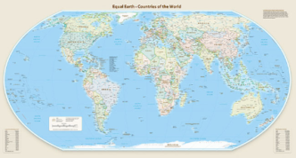
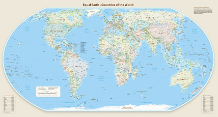
The United Nations General Assembly has endorsed a new world map that presents Africa and other continents closer to their actual proportions, replacing the distorted impression created by the widely used Mercator projection.
Gatekeepers News reports that the resolution, adopted on September 4, 2026, was backed by 164 countries, while the United States voted against it and six countries abstained. The initiative was spearheaded by Togo with support from the African Union and other countries.
The new approach promotes the Equal Earth projection, which more accurately represents the relative sizes of landmasses. Under the traditional Mercator projection, areas farther from the equator appear significantly larger than they actually are, while Africa and other equatorial regions appear comparatively smaller.
For instance, Mercator maps can make Greenland appear comparable in size to Africa, even though Africa is about 14 times larger than Greenland. The new projection corrects much of this distortion, making Africa visibly larger while North America and Europe appear smaller.
The Mercator projection was developed in the 16th century primarily for navigation. While useful for sailors because it preserves directions, it does not accurately preserve the size of continents and countries.
Supporters of the resolution say the change will encourage more accurate geographical representation in schools, educational materials, media and digital platforms. The resolution is, however, not legally binding, meaning it does not prohibit the continued use of the Mercator map.
The United States was the only country to vote against the resolution, reportedly describing the initiative as an ideological distraction from more pressing global issues.
UN resolution marks a significant move away from the centuries-old Mercator projection and towards a map that gives a more proportionate visual representation of Africa and other regions.